
Met Éireann in snow forecast for Ireland amid Arctic cold snap as temps plunge

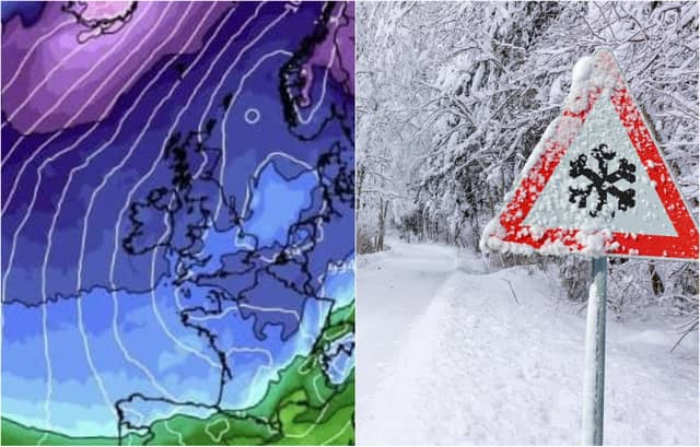

Met Éireann has given a clear indication that snow could fall in some parts of Ireland next week
Met Éireann is predicting snow for some parts of Ireland next week in their extended range forecast.
Weather experts are monitoring the cold front on its way to Ireland and Met Éireann has given its first indication that the Arctic blast could result in wintry falls of hail, sleet or even snow.
For next week, the Met Éireann forecast reads: "Colder than average with low pressure centred to the east dominating. Arctic maritime regime indicated with potential for wintry hazards including hail, sleet and snow. Rainfall amounts above average, especially near coasts, indicative of shower activity."
The week after will bring a more Atlantic regime to Ireland but it could remain unsettled with windy weather.
Met Éireann says from November 25, "high pressure looks set to be centred to the south over Iberia. This would likely lead to a milder southwesterly airflow and a potentially more mobile Atlantic regime with spells of rain and possibly windy conditions crossing the country, interspersed with drier and brighter interludes. Temperatures are projected to be slightly above average overall along with wetter than average conditions."
Meanwhile, Cathal Nolan from Ireland's Weather Channel has also said the risk of snow in Ireland has increased and that we could experience the coldest November week since 2010 next week.
Cathal said: "Well now this is an interesting one, especially for those who have a keen interest in cold wintry conditions, adding, "this morning's weather models continue to build confidence that we may be on the cusp of experiencing the coldest November week since 2010."
Cathal added: "A strong blocking anticyclone is now expected to develop late this weekend just east of Greenland with a large area of low pressure over Scandinavia resulting in a direct stream of bitterly cold Arctic air migrating south across Ireland and the UK, bringing an increased risk of snow for some.
"If the weather models continue to grow in confidence then temperatures next week by day would struggle to break above 2-4 degrees Celsius, with nighttime values down as low as -5 or -6 degrees Celsius in some sheltered areas of the midlands and southeast.
"The all important question however is will it snow? The answer at the moment is that the chances of snow are increasing, though with the snow falling as showers it’s areas of the north and northwest that would be most at risk, and possible along some exposed eastern coastal fringes."
In the meantime, Met Éireann say there will be "a good deal of dry weather this week, though cloud cover will increase with patches of rain and drizzle at times. However, rainfall amounts will be minimal. Temperatures will be close to normal."