
Ireland on storm alert as experts track 'truly massive' bomb cyclone heading our way

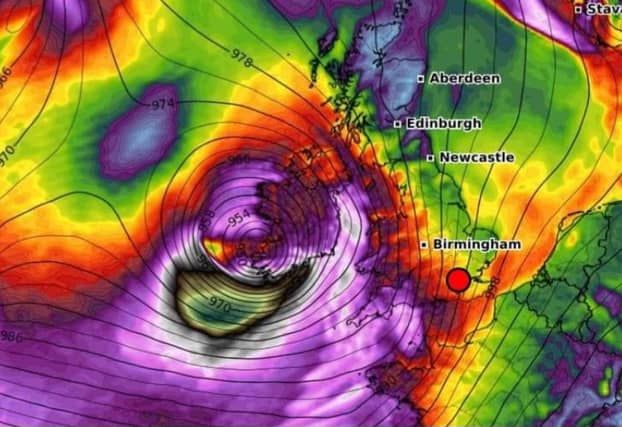

Severe weather warnings are likely this week as a "powerful jet stream" propels a huge storm over Ireland.
Met Eireann has not issued any warnings yet but its latest forecast recognises the threat posed by the powerful system.
In the US, weather expert Ryan Maue says he is "watching track of developing truly massive bomb cyclone for Ireland and Britain on Wednesday."
He says "central pressure in the 940s and hurricane force winds are possible."
He later added that there is "still plenty of uncertainty about location and magnitude of impacts from the powerful bomb cyclone to strike Ireland, Britain, and France with damaging wind gusts up to 100 mph mid-week.
"The climate fueled storm is energised by a super strong jet stream," he concluded.
Met Eireann says Wednesday will start bright with "sunshine and showers but further rain later in the day.
"Turning windy or possibly stormy Wednesday night and Thursday, depending on the track of a low pressure area," their forecast continued.
Weather Alerts Ireland says "a very powerful jet stream is expected to push low pressure systems towards Ireland next week" with "a risk of a storm for Ireland on Thursday."
It is still possible for models to change but so far they agree on some fairly wild weather for Ireland in the middle of next week.