
Hail, sleet and maybe a sprinkle of snow for the week ahead according to latest forecast

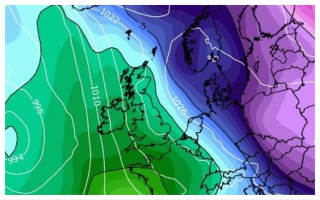

Met Éireann has forecast cold and wet conditions cross the country
It looks like the cold spell is expected to continue throughout the country this week according to Met Éireann's latest forecast.
Monday was off to cold and dull start, particularly in eastern and northern coastal areas. Luckily for the west, some bright and sunny spells will occur throughout the day. Unfortunately, the dry weather won't last long as rain and some showers of hail will spread from northern and eastern counties through the day.
There will also possibly be some sleet and snow in areas of high ground later on Monday. The temperatures will remain chilly, ranging from 4 to 7 degrees.
Monday night will be another cold one with frost and icy patches where the skies are clear. Patchy rain or drizzle will persist throughout the night with the odd chance of hail or sleet. Temperatures will dip between -1 and +3 degrees.
READ NEXT: LATEST: Suspect in 'random' stabbing attacks in Dublin not an asylum seeker, says Justice Minister
Tuesday will see some bright spells in the morning, clearing any frost or ice. Although, as the day develops, it will be mostly cloudy with patchy showers, particularly across the east and southeast. As the rain spreads into southwestern counties later in the day, some of these showers could turn wintry on high ground. Temperatures will reach from 5 to 7 degrees.
The rain will continue into Tuesday night. Lowest temperatures of 1 to 5 degrees are expected, with the west being the coldest.
Wednesday will be another wet day with outbreaks of rain and some wintry falls locally. Highest temperatures will range between 4 and 8 degrees in a fresh southeast breeze.
Similarly, Wednesday night will see further scattered rain showers. Lowest temperatures will fall between 1 and 5 degrees but the extensive cloud cover should diminish the possibility of frost developing.
Thursday will see even more rain across southwest areas which will gradually extend northeastwards throughout the day. There's also a chance that these showers could become wintry. Highest temperatures of 4 to 9 degrees in sharp southeast winds.
Thursday night will continue to be wet, cold and breezy.
Friday will be another cold and wet day with the potential for spot flooding across southern and eastern areas. Some sunny spells may break through in west and southwest counties. Temperatures will range between 5 and 7 degrees.