
Ferocious storm on course for 'direct hit' with Ireland in brutal forecast

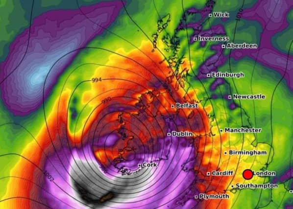

A storm brewing in the Atlantic looks like it will strengthen before making a direct hit on Ireland in the middle of next week, according to one forecaster.
Weather Alerts Ireland has been tracking the storm and says that "weather models this evening are more in favour of a direct hit from this storm on Wednesday."
"This mornings UK and Europe models were not showing a direct hit but all models seem to be in favour of this system hitting Ireland," the forecast added.
The current evening models forecasting this system are the ECMWF, UKMO, ICON, ICON EU, ARPEGE and GFS.
"The jet stream will strengthen this system as it crosses the Atlantic Ocean and will push very close/over Ireland on Wednesday.
"The ECMWF model is shown in the video and shows very strong winds for Ireland with the strongest in the South of the country.
"Other models show stronger winds and the system slightly more west bringing strongest winds to more of the South and South West of the country," the alert added.
"These are updates based on the current models. It is difficult to predict wind paths this far out, hopefully the strongest of winds will stay away from Ireland," they concluded.
Meanwhile, Met Eireann has said: "While details are still uncertain, current indications suggest that Wednesday could be a very windy or possibly stormy day with heavy rain and very strong winds in all areas for a time."