
ALERT: Met Éireann forecast predicts temps as high as 25C AND thundery downpours!

Ah here!
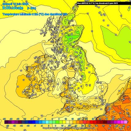
The warm and humid air is moving in now and it will be much warmer on Friday night with temperatures not dropping below 17C in some parts.
"Welcome to the sticky, muggy weather," forecaster Alan O'Reilly added.
"Showers will also kick off but very hard to pinpoint where they will hit. A risk of heavy thundery downpours locally especially over the weekend," he said.
Met Éireann's forecast predicts:
SATURDAY: Saturday will be warm and humid with a mix of cloud and sunshine. Scattered showers, mainly over Munster at first, will gradually extend into other parts of the country, some turning heavy with the chance of isolated thunderstorms and spot flooding. Highest temperatures of 19 to 24 or 25 degrees, coolest in the south, in a light to moderate east to southeast breeze.
OUTLOOK: Warm and humid, both by day and night with showers - thundery downpours in parts. Some mist and fog too.
SATURDAY NIGHT: Humid and very mild with scattered showers tracking northwards, some heavy and thundery with possible flooding. Some mist or fog setting in later too. Lowest temperatures 14 to 16 degrees Celsius with just light southerly breezes.
SUNDAY: A mix of cloud and summer sunshine with well scattered showers too - potential for local thundery ones. Warm and heavy with top temperature of 20 to 25 degrees Celsius, all sunshine dependent with very little breeze, save local sea breezes.
MON and TUES: Warmer or even hot days with sunshine and scattered slow moving showers - potential for heavy and thundery ones with possible flooding.
Parts of the country staying fully dry though. Top temperatures of 20 to 26 degrees Celsius, in just light variable or northeasterly breezes.